Hinweis: Das ist ein alter - nicht mehr gewarteter - Artikel des AEIOU. Im Austria-Forum finden Sie eine aktuelle Version dieses Artikels im neuen AEIOU.
Floridsdorf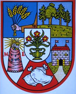
© Copyright Wappen des 21. Wiener Gemeindebezirks Floridsdorf. Floridsdorf, 21. Gemeindebezirk von Wien, 44,46 km2, 136.321 Einwohner (2006), am linken Donauufer, im westlichen Marchfeld. Floridsdorf wurde 1904 mit den Orten Jedlesee, Großjedlersdorf, Donaufeld, Leopoldau, Kagran, Hirschstetten, Stadlau und Aspern zu Wien eingemeindet, wozu 1910 noch Strebersdorf kam. 1938 verlor Floridsdorf Kagran, Stadlau, Hirschstetten, Aspern und die Lobau an den neu gebildeten 22. Bezirk (Donaustadt), 1954 erfolgten eine Neuabgrenzung gegenüber dem 22. Bezirk und Niederösterreich und die Eingemeindung von Stammersdorf. - Die Siedlung hieß zunächst "Am Spitz" und wurde dann nach dem Klosterneuburger Abt Floridus Leeb, der 1786 Klostergründe an Siedler abgegeben hatte, benannt. Ursprünglich vor allem agrarisch, entwickelte sich Floridsdorf durch zahlreiche Industrieanlagen, durch die Nordwestbahn und die 1885 eingeführte Dampftramway rasch und wurde 1894 zur Stadt erhoben. Stadtrandsiedlungen mit Schrebergärten und Bauern; Großfeldsiedlung (1966-73); Nordrandsiedlung; Siedlung Jedlesee (nach 1949); neues Siedlungsgebiet Neu-Stammersdorf zwischen Brünner Straße und Jedlersdorfer Straße (76 ha, seit 1992). Gemeindebauten (Schlingerhof, 1925/26; Karl-Seitz-Hof, 1926/27; Paul-Speiser-Hof, 1931/32). Schulzentrum (1966), Nittel-Hof (1976-83); Veterinärmedizin. Universität (1995/96); Siegfried-Marcus-Berufsschule (1989); Pädagogische Akademie der Erzdiözese Wien (1971); Ausbildungszentrum für Sozialberufe (1978); Haus der Begegnung (1968, an der Stelle des früheren Floridsdorfer Arbeiterheims von 1909); Shopping-City-Nord (1989); Van-Swieten-Kaserne (Heereskrankenanstalt). Bezirksmus. im ehemaligen Mautner-Schlößl (seit 1960); Paul-Hock-Park (ehemaliger Floridsdorfer Ortsfriedhof). Schulbrüderkirche Strebersdorf (1887), Donaufelder Kirche (1905); Floridsdorfer Kirche (1936-38). Zahlreiche Industrie- und Gewerbebetriebe; Schnellbahn- und U-Bahnanschluss (U6). Westteil mit Alter Donau (Wasserpark, Angelibad), Marchfeldkanal. Literatur: F. Czeike, Floridsdorf, Wiener Bezirkskulturführer, 1979; derselbe, Historisches Lexikon Wien, 5 Bände, 1992-97; H. Hinkel und K. Landsmann, Floridsdorf von A-Z, 1997.
| |||||||||||||||||||||||||||||||||||


